Our Mission
As the named Land Management Entity of the Conservation Easement, Friends of Sears Island Advises, Oversees and Manages the Protected Property in accordance with the terms of the Conservation Easement dated February 22, 2009.
The mission of the Friends of Sears Island (FOSI) is to support permanent protection of Sears Island’s environmental and cultural resources; preserve its marine, shoreland, and forest ecosystems; and encourage educational and low-impact recreational uses of the island.
Sears Island History
According to Joel Eastman’s book A History of Sears Island, Sears Island was originally called Wassumkeag by Native Americans, meaning “bright sand beach.” Before the causeway was built, a shining sandbar connected the island to the mainland at low tide. Wassumkeag was an important navigation beacon for Native Americans paddling their birchbark canoes around Penobscot Bay. After portaging across the neck of Cape Jellison, paddlers were guided to Wassumkeag by the sight of the sand beach, eliminating a long paddle around two bodies of land that jut out into Penobscot Bay.
Archaeological records confirm that Native Americans started camping on the island over 3,400 years ago, using it as a base for hunting, fishing, and resting along paddling routes. These were the primary human uses of the island until Europeans arrived in the 1600s.
In the early 17th century, newly arrived French and English settlers fought with local Native Americans over land around Penobscot Bay which the colonizers sought to claim for their own. In 1730, Boston merchant Samuel Waldo asked the English King’s Council for a land grant. He was rewarded with a large parcel of land taken from the local tribes, which included Wassumkeag Island, renamed Brigadier’s Island in honor of Waldo, a brigadier general.
In 1779, the largest American naval defeat before Pearl Harbor took place at the mouth of the Penobscot River. When, as part of the Revolutionary War, the British invaded Castine, Massachusetts sent 44 vessels in response to reclaim it. The early Americans failed and the crews abandoned and then burned their own retreating ships to prevent the British from capturing the vessels and their contents. One American ship, the Defence, tried unsuccessfully to hide in Stockton Harbor. When the British discovered it, the captain ordered the ship blown up. In 1975, students from Maine Maritime Academy discovered artifacts from this historic battle in Stockton Harbor using sonar. A subsequent archaeological excavation unearthed many items preserved in the mud. The site is now protected under state and federal law and remains property of the U.S. Navy.
After Samuel Waldo’s death in 1759, his daughter Lucy married Henry Knox. In 1794, Knox traveled to Brigadier’s Island, where he paid the people squatting there to leave. He then hired “an industrious husbandman,” John Rynier, to turn much of the island into a grazing farm for oxen, cattle, sheep, and hogs. He also built a farmhouse, the remains of which are still visible just off the Homestead Trail. In 1804, Knox transferred ownership of the island to a creditor.
In 1806, several men owned shares in Brigadier’s Island; one of them, David Sears, bought out his partners in 1813. Ownership of the island was then passed down through four generations of the Sears family, who owned much land in the area now known as Searsport. Farming continued on Sears Island for over a century. While the Sears family never lived year-round on the island, they built a summer home at the southern end in 1853, which burned 40 years later.
In 1905, the Bangor Investment Company, part of Bangor & Aroostook Railroad, bought the island to develop a resort which was never built. Farming the land ultimately proved to not be a successful endeavor, and in 1934 the vacant buildings were demolished. As the island returned to a more natural state, locals viewed it as a public recreation area, even using it as a drop-off point for smuggling liquor during Prohibition.
Since the 1970s, Sears Island has been threatened by several industrial development plans, all of which were ultimately rejected. In the late 80s, the state took 50 acres of the island by eminent domain/purchase, and bought most of the remainder in 1997. In 2009, an agreement was reached to place 601 acres in permanent conservation while the state retained retains 335 acres for possible future use as a cargo or container port. Maine Coast Heritage Trust holds the conservation easement and Friends of Sears Island (FOSI) is the designated land manager, responsible for protecting the island’s natural and cultural resources.


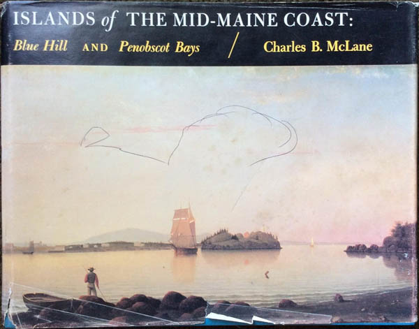
Click on the image to read an excerpt from “Islands of the Mid-Maine Coast: Blue Hill and Penobscot Bays,” by Charles B. McLane, published in 1982 by The Kennebec River Press, Inc. This excerpt is the five pages of the book with the history of Sears Island, including some additional details that are not included in Joel Eastman’s booklet.
FOSI Board & Advisory Group

Board of Directors
Vice President: Rolf Olsen, Searsport, ME
Secretary: Janet Williams, Searsport, ME
Treasurer: Jim Gilbert, Winterport, ME
Greg Biddinger, Belfast, ME
Steve Bulloch, Searsport, ME
Rob Burke, Newburgh, ME
Sandi Cirillo, Searsport, ME
David Italiaander, Searsport, ME
Jill Kulbe, Searsport, ME
Robert E. Ramsdell (Emeritus), Brunswick, ME
Advisory Group
Mayo Bulloch, Searsport, ME
Cloe Chunn, Swanville, ME
Derek Dunbar, Searsport, ME
Josh Goldstein, Belfast, ME
Timothy Haugh, Brewer, ME
Stephene Kelley, Searsport, ME
Marjorie Knuuti, Searsport, ME
Bill Kulbe, Searsport, ME
Tom Mullin, Richmond, ME

